Log in
All resources
Create a design
33,167 Free Images of 1552 Maps
maps in the library of congress
mitchell's school atlas
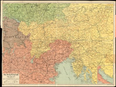
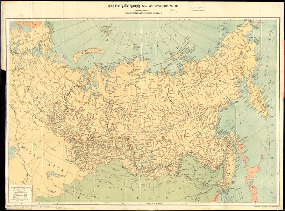
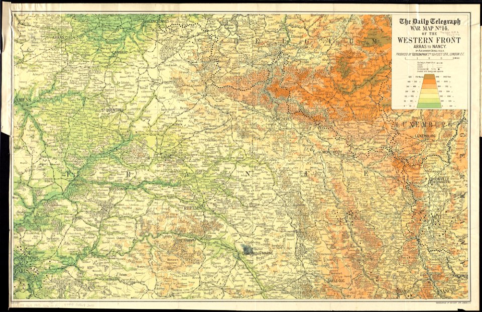
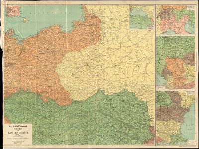
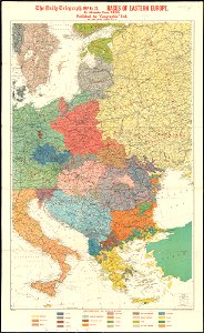
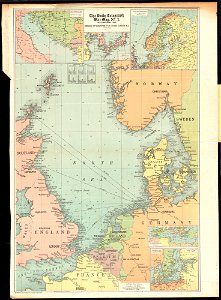
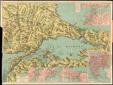
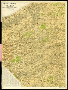
maps of world war i by the daily telegraph
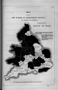
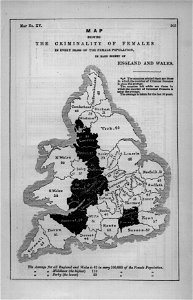
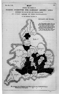
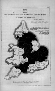
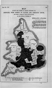
maps in london labour and the london poor (1851)
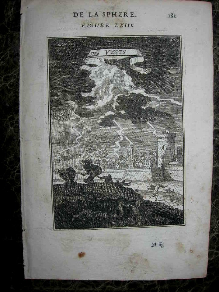
geographical illustrations by coronelli
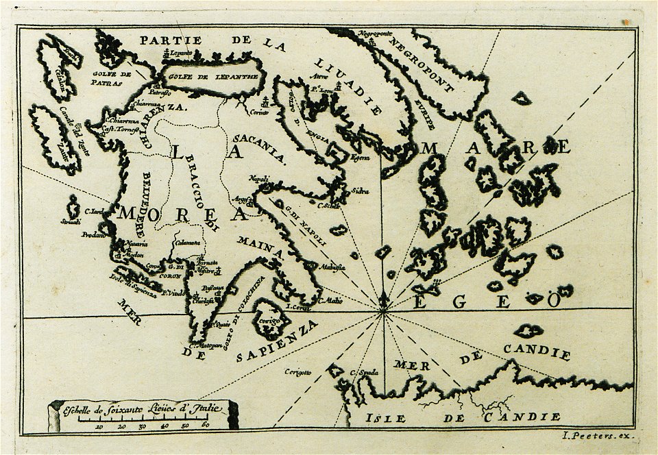
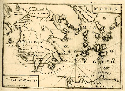
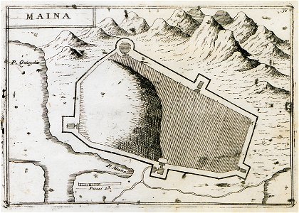
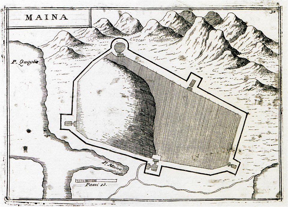
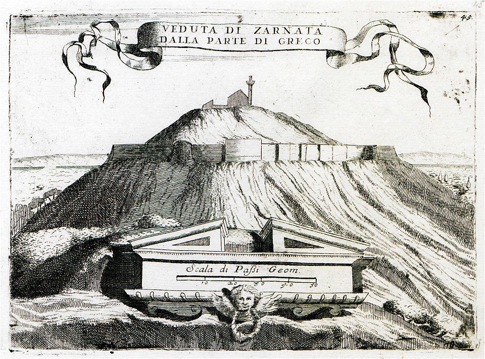
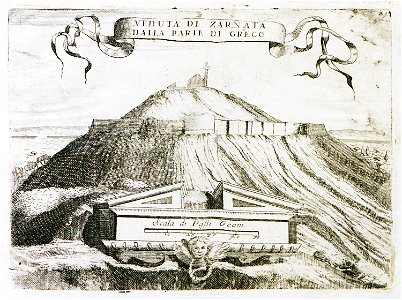
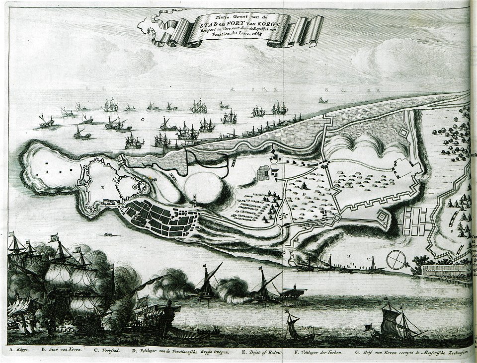
old maps of the peloponnese
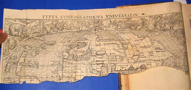
cosmographia (1600) by sebastian münster
description de l'universe
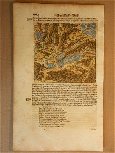
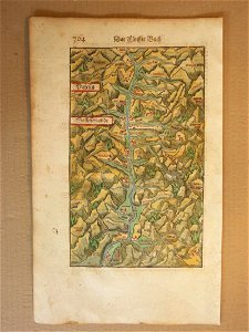
old maps of switzerland
old maps of greece
maps in london labour and the london poor (1851)
illustrations of cosmographia (münster)
old maps of the world
cosmographia (1600) by sebastian münster
old maps of switzerland
maps in london labour and the london poor (1851)
cosmographia (1600) by sebastian münster
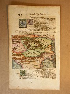
1600 maps of transylvania
maps in london labour and the london poor (1851)
maps in london labour and the london poor (1851)
cosmographia (1600) by sebastian münster
old maps of switzerland
maps in london labour and the london poor (1851)
maps in london labour and the london poor (1851)
maps in london labour and the london poor (1851)
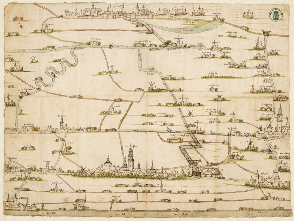
drawings in the stadsarchief amsterdam
old maps of amsterdam
description des principales villes (1690)
old maps of greece
geographical illustrations by coronelli
old maps of the peloponnese
cosmographia (1600) by sebastian münster
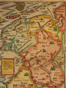
old maps of friesland
cosmographia (1600) by sebastian münster
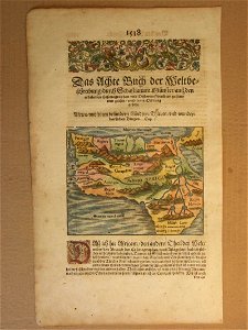
1600s maps of africa
geographical illustrations by coronelli
old maps of the peloponnese
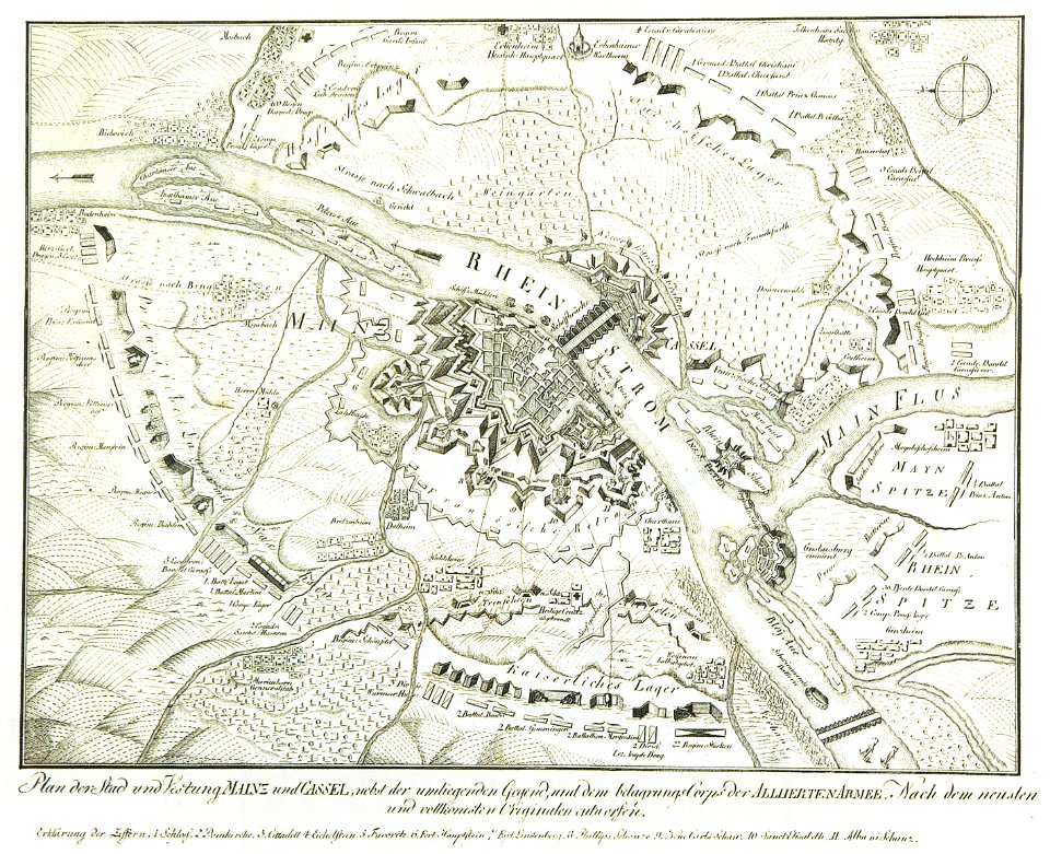
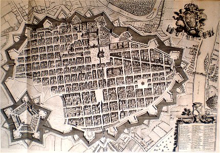
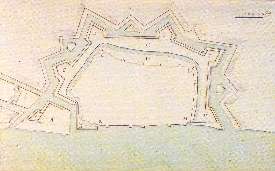
mainz in the 18th century
historical maps of mainz
geographical illustrations by coronelli
old maps of the peloponnese
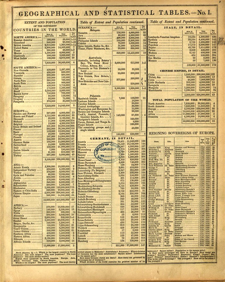
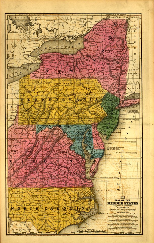
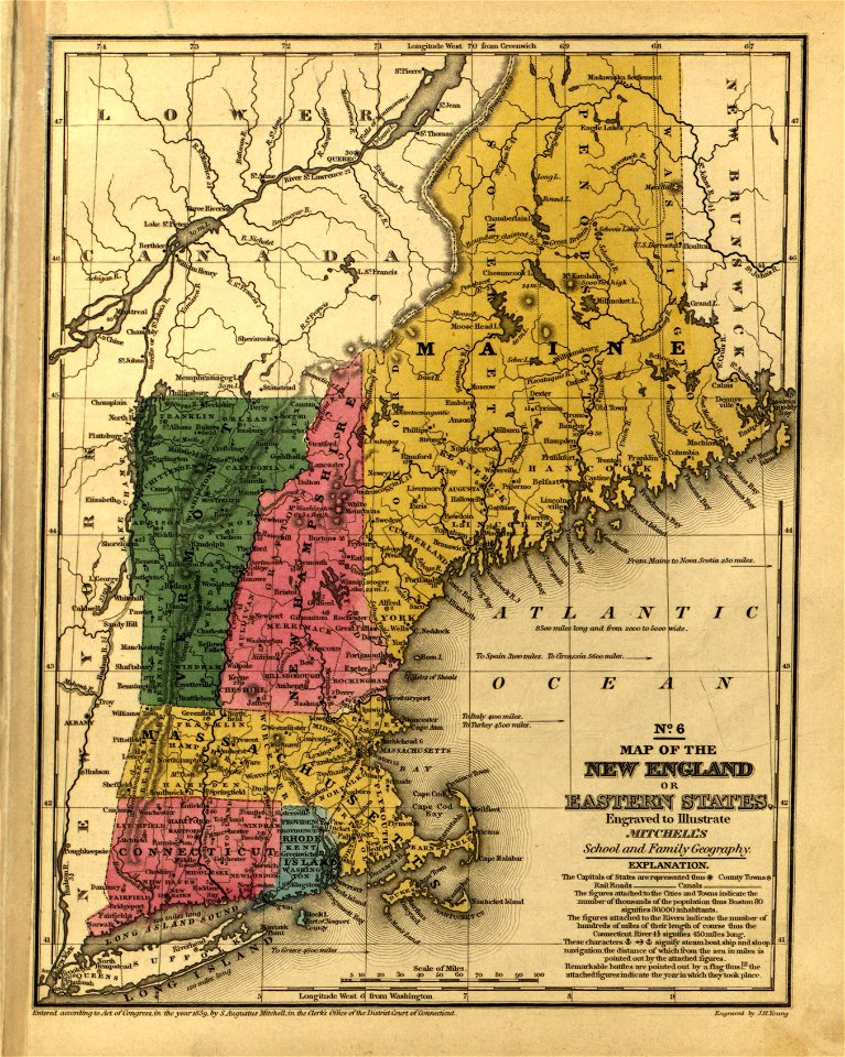
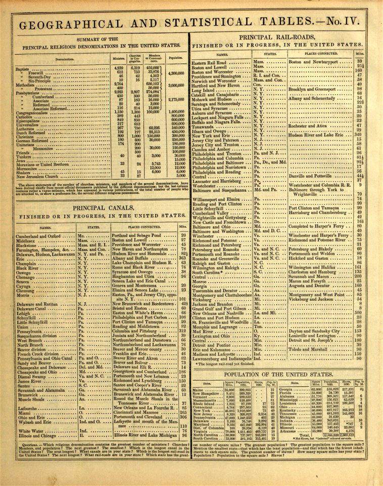
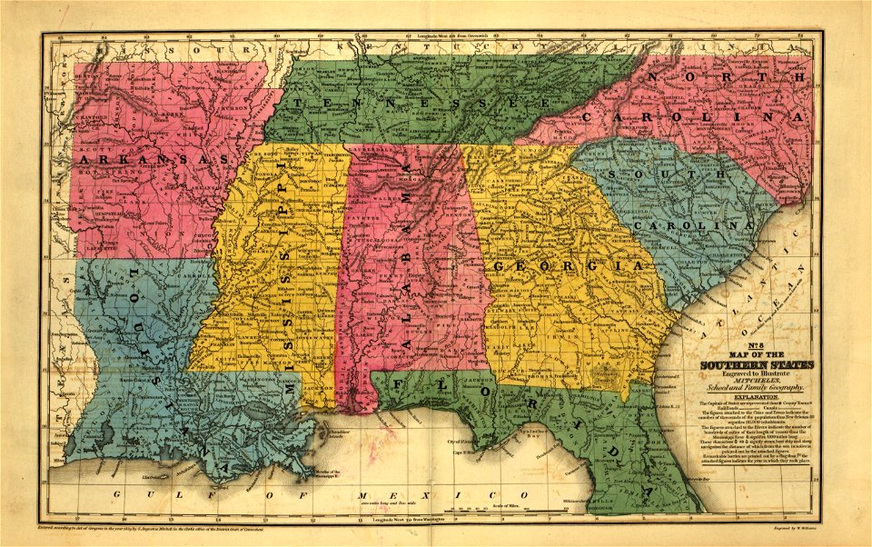
maps in the library of congress
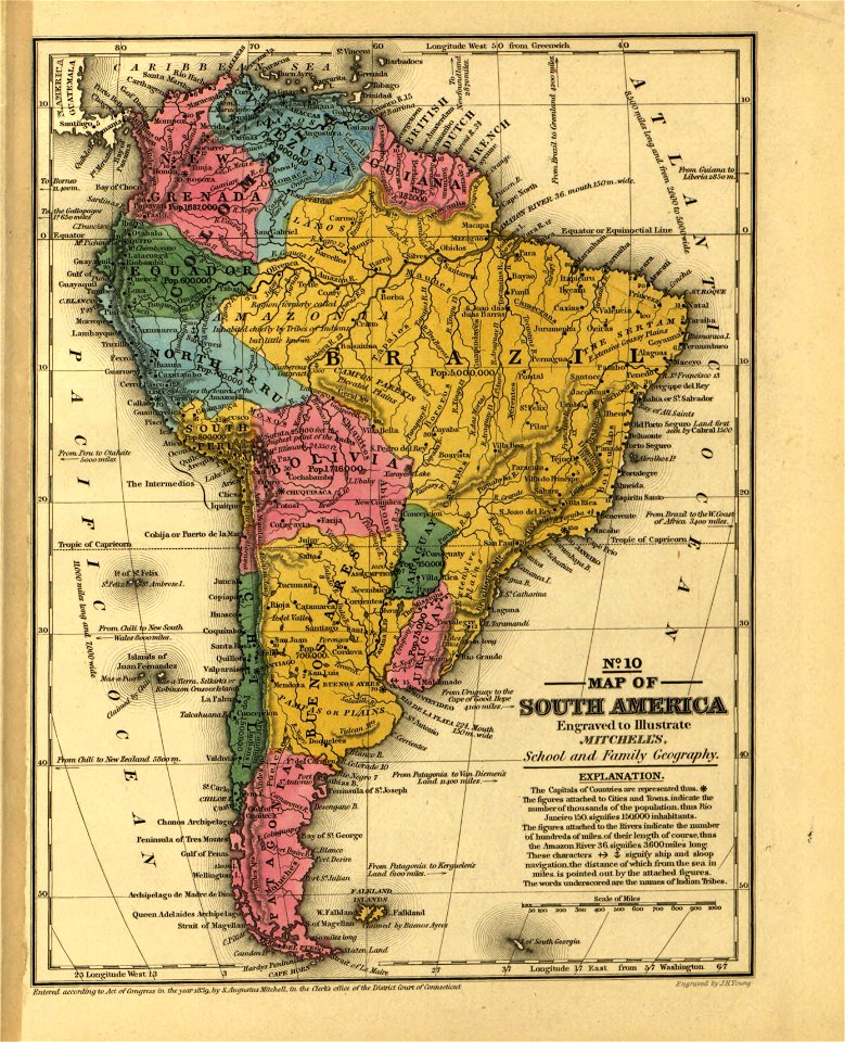
mitchell's school atlas
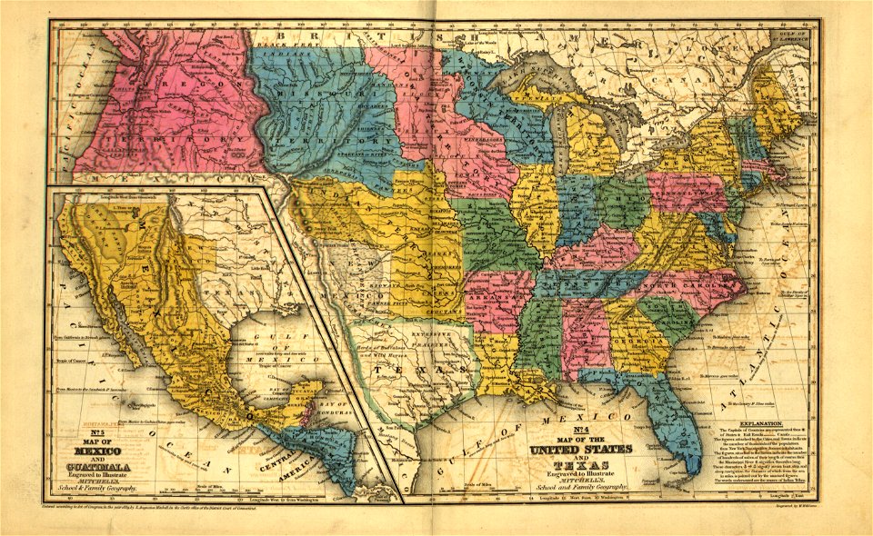
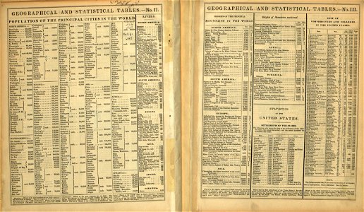
maps in the library of congress
mitchell's school atlas
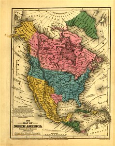
maps in the library of congress
mitchell's school atlas
maps in the library of congress
mitchell's school atlas
maps in the library of congress
mitchell's school atlas
maps in the library of congress
mitchell's school atlas
maps in the library of congress
mitchell's school atlas
maps in the library of congress
mitchell's school atlas
maps in the library of congress
mitchell's school atlas
maps in the library of congress
mitchell's school atlas
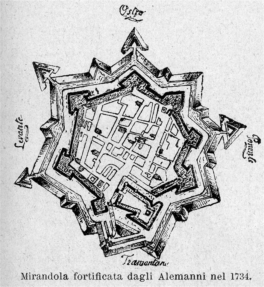
le cento città d'italia (modena)
old maps of mirandola
maps in the library of congress
mitchell's school atlas
maps in the library of congress
mitchell's school atlas
maps in the library of congress
mitchell's school atlas
maps in the library of congress
mitchell's school atlas
maps in the library of congress
mitchell's school atlas
maps in the library of congress
mitchell's school atlas
maps in the library of congress
mitchell's school atlas
maps in the library of congress
mitchell's school atlas
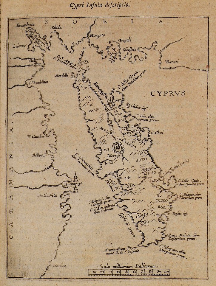
itinerarium hierosolymitanum et syriacum..., 1619
old maps of cyprus
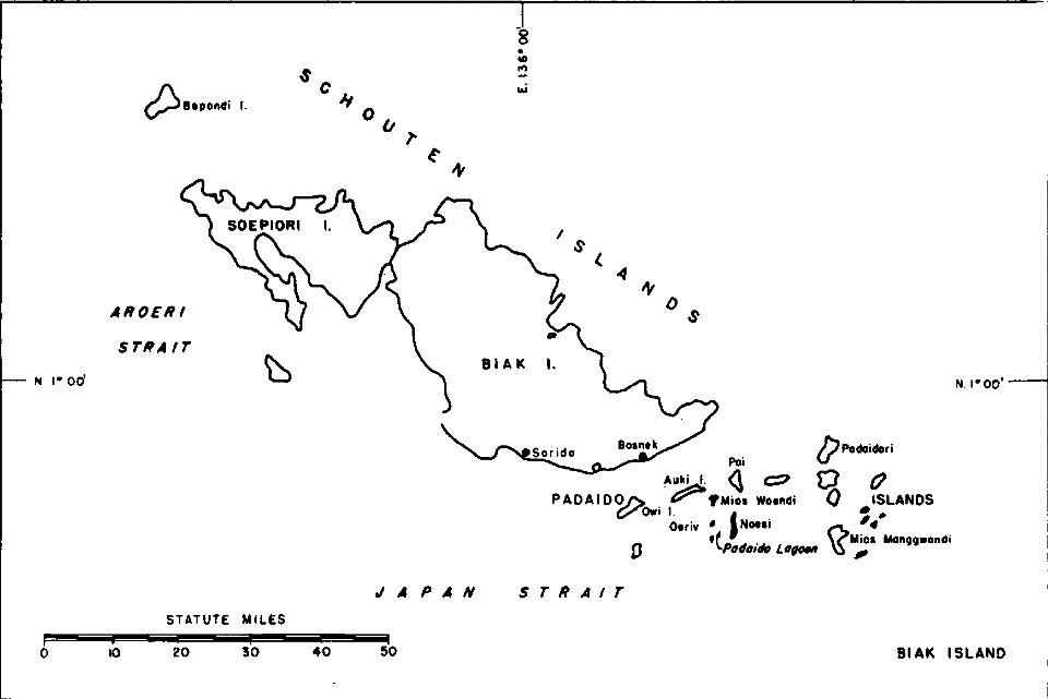
1940s maps of indonesia
biak
cosmographia (1600) by sebastian münster
old maps of friesland
maps in the library of congress
mitchell's school atlas
maps in the library of congress
mitchell's school atlas
maps in the library of congress
mitchell's school atlas
maps in the library of congress
mitchell's school atlas
maps in the library of congress
mitchell's school atlas
maps in the library of congress
mitchell's school atlas
maps in the library of congress
mitchell's school atlas
geographical illustrations by coronelli
old maps of the peloponnese
old maps of turin
1674 engravings
geographical illustrations by coronelli
old maps of the peloponnese
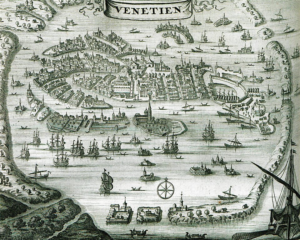
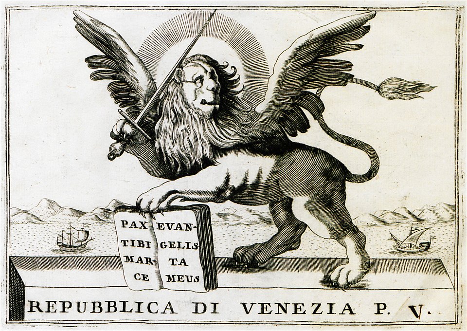
old maps of venice
venice in art
prints in the rijksmuseum amsterdam
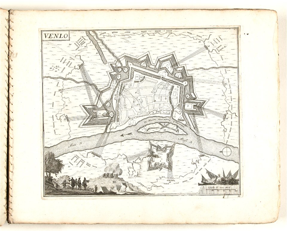
old maps of venlo
geographical illustrations by coronelli
old maps of the peloponnese
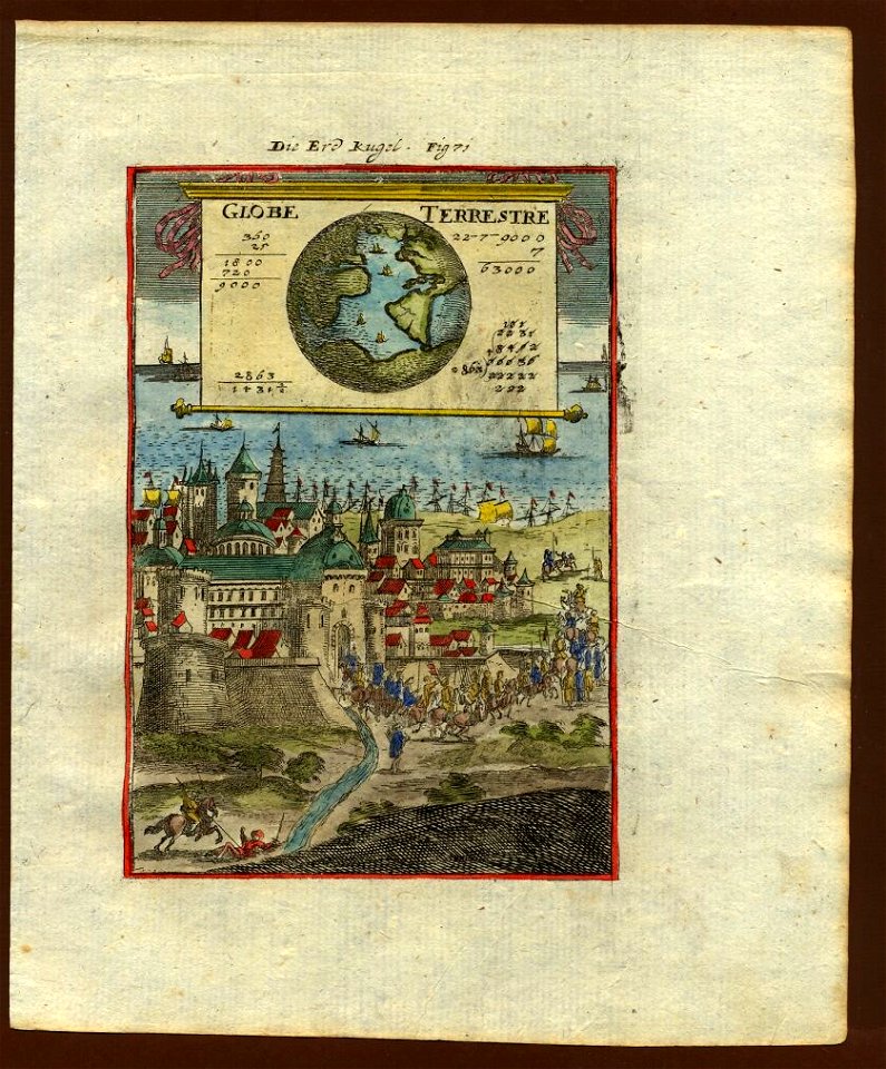
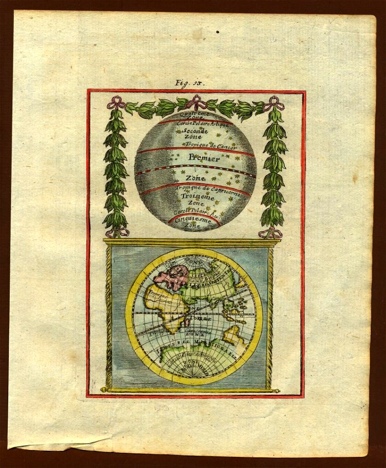
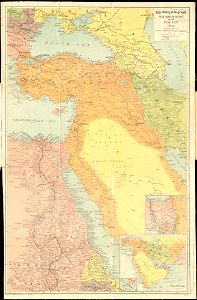
17th-century maps of the world
description de l'universe
18th-century maps of the world
description de l'universe
17th-century maps of the world
description de l'universe
18th-century maps of the world
description de l'universe
geographical illustrations by coronelli
old maps of the peloponnese
russo-turkish war (1735—1739)
maps by matthäus seutter
postcards of świnoujście
maps of świnoujście
old maps of marseille
french navy bases
maps of paris in the 1730s
plan de turgot
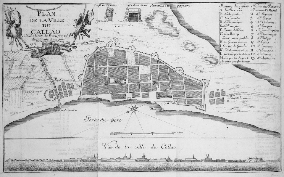
historical images of el callao
frézier's travel
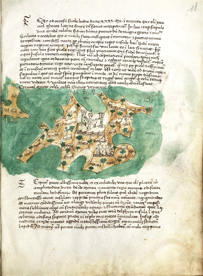
old maps of greece
olfert dapper
the illustrated london news 1857
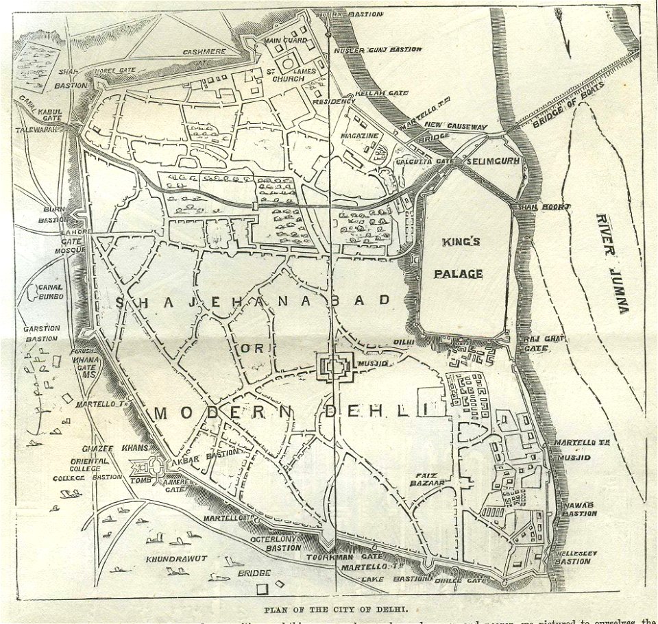
old maps of delhi
travels in sicily greece and albania
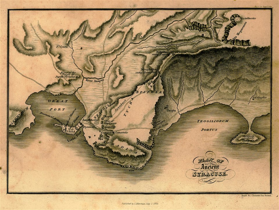
maps of syrakousai
johann christoph brotze
old maps of riga
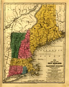
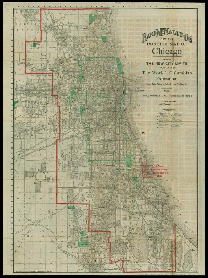
chicago and the midwest
newberry library
1885 maps
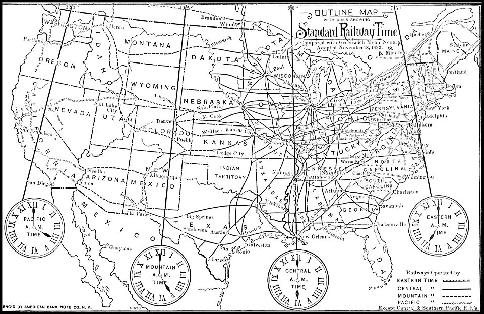
time
popular science monthly illustrations/volume 48
ice age maps
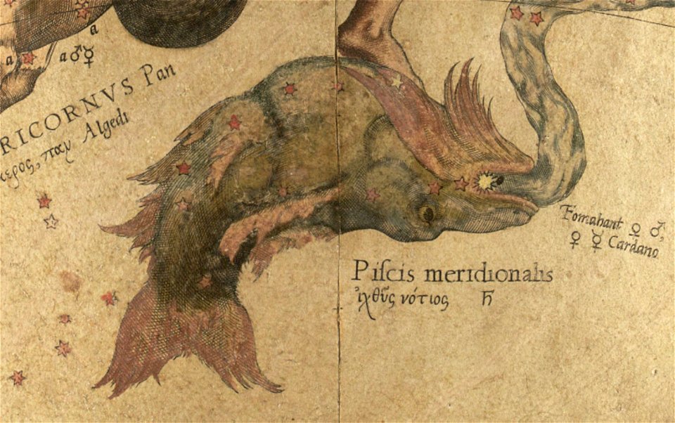
maps by gerardus mercator
mercator celestial globe
liber insularum archipelagi (royal museums greenwich)
maps of milos
art works by daniel meisner
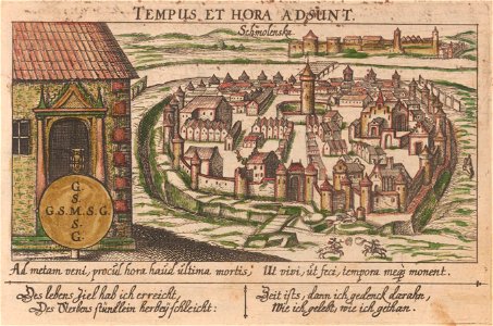
old maps of smolensk
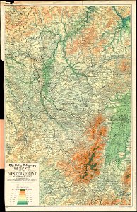
maps of world war i by the daily telegraph
liber insularum archipelagi (royal museums greenwich)
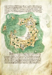
maps of syros
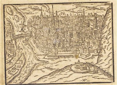
theatrum urbium (1610)
old maps of rouen
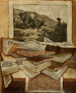
maps in art
disorder
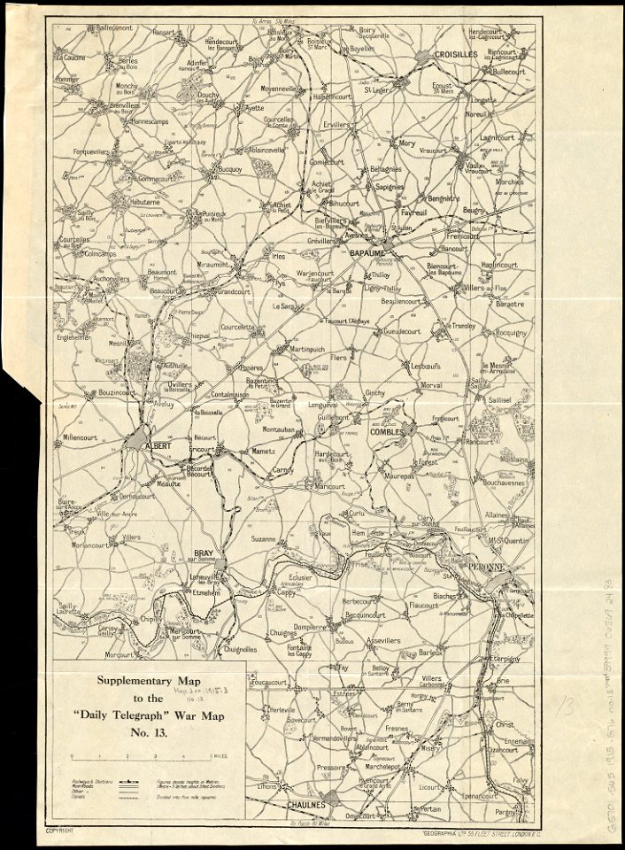
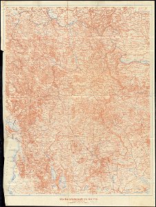
maps of world war i by the daily telegraph
maps of world war i by the daily telegraph
maps of world war i by the daily telegraph
maps of world war i by the daily telegraph
maps of world war i by the daily telegraph
maps of world war i by the daily telegraph
maps of world war i by the daily telegraph
maps of world war i by the daily telegraph
maps of world war i by the daily telegraph
maps of world war i by the daily telegraph
maps of world war i by the daily telegraph
maps of world war i by the daily telegraph
maps of world war i by the daily telegraph
maps of world war i by the daily telegraph
maps of world war i by the daily telegraph
maps of world war i by the daily telegraph
maps of world war i by the daily telegraph
maps of world war i by the daily telegraph
maps of world war i by the daily telegraph
maps of world war i by the daily telegraph
maps of world war i by the daily telegraph
maps of world war i by the daily telegraph
7201 - 7300 of 33,167
Next page
/ 332